Sunday, 5 December 2010
Thursday, 2 December 2010
the seven hills
The old (historical) city of Istanbul is supposed to be built on seven hills which have been located within the walls of the ancient city of Istanbul. They can be found within the city’s three corners. The Bayrampasa River separates the three highest hills of the city. While the two hills are parallel along with the Golden Horn, the third hill lies down towards south. The city of Rome was also built on seven hills. So the number seven is not random, on the contrary it is supposed to be a sacred number in many religions and mythology. Both Rome and Constantinople were known as the cities of seven hills with seven central points in each of the two cities. Six of the hills of Istanbul accommodate imperial mosques which are the ones to provide the city its Ottoman identity. They all are fundamental features of the city during Ottoman era. The ancient city of Byzantium was built on the first hill which begins from Seraglio Point and continues up to Topkapi Palace, Hagia Sophia and the Sultan Ahmet Mosque.
The second hill that is divided by a deep valley has Grand Bazaar, Column of Constantin and the Nuruosmaniye Mosque.
The second hill that is divided by a deep valley has Grand Bazaar, Column of Constantin and the Nuruosmaniye Mosque.
The third hill has Suleymaniye Mosque to the North, the Bayezid II Mosque to the south and Istanbul University.
The fourth hill has the Fatih Mosque and the Church of the Holy Apostles.
The fifth hill has the Mosque of Sultan Selim.
The sixth hill includes the districts of Ayvansaray and Edirnekapi.
The seventh hill begins from Aksaray and goes on to include Marmara. It has three summits that produce a triangle at Yedikule, Aksaray and Topkapi.
the expansion of the old city
This is an image showing the expansion of the city throught time in accordance with the building of the three major walls constrcted in the old Istanbul.
The gates of the Theodosian walls(that still exist) are also spotted, as well as the religious buildings of the city( churches and monasteries).
The dotted lines indicate the boundaries of the existing districts in the region.
The gates of the Theodosian walls(that still exist) are also spotted, as well as the religious buildings of the city( churches and monasteries).
The dotted lines indicate the boundaries of the existing districts in the region.
Wednesday, 1 December 2010
city within walls/ gates to different places
Below is a sketch concentrating on the development of the city inside its walls. It shows all three stages of the city, the first with the old walls, the later expansion with the Constantine walls and last the important construction of the thick Theodosian walls.
There is also a sketch pointing out the gates of the Theodosian walls and a section through them.
Each gate of the Theodosian walls had each own purpose and its own history.
The way I see it is that each gate is a door to another world and even maybe a different point in history.
The 1st military gate gave access only to fortifications.
The Golden gate was supposed to be only for the emperors, special visitors and processions.
The Yedicule gate leads to the towers of Yedicule which held prisoners and state treasure.
The Belgrade gate is the 2nd military gate.
The Siliviry gate was the 1st large public gate.
The Topkapi gate used to be the main route into the city.
The Edirne gate is the gate that Sultan Ahmet entered in 1453 after his triumph.
The Tekfur Saray was a palace built into the thickness of the wall.
a little bit of history
Istanbul is the city of 3 religions and 2 continents.
The very first settlement of the city was in Kadıköy by the Greeks from the Megara. On this first hill the Acropol was built and it is when the Byzantium was established.
The ancient city expanded and became double its size with Constantine who actually built the plans of the new city himself building thick walls all around it.
In 203 AD the Severus Hippodrome was built, and the area outside the Hippodrome became the center of the peninsula and was known as the old city of Istanbul. The zero counting point of all roads, the million stone, was placed in the center of Istanbul, so that also was the center of the world.
The Buyuk Saray, also known as the Sacred Palace, was located in the ancient Istanbul from 330 to 1081 AD and served as the main royal residence of the Eastern Roman or Byzantine Emperors.
In the 5th century Emperor Theodosius the II built 6 km thick stone defensive walls outside the old city and so protected Constantinople for more than 1000 years.
After Christianity was imposed churches started replacing paganist temples. That is the time when Hagia Sophia was first built. Of course it went through many phases and catastrophes before the final masterpiece we know was built. The current building was originally constructed as a church between 532 and 537 on the orders of the Byzantine Emperor Justinian and was the third Church of the Holy Wisdom to occupy the site, the previous two having both been destroyed by rioters. It was designed by Isidore of Miletus, a physicist, and Anthemius of Tralles, a mathematician. Hagia Sophia was the first basilica church with a dome built in only 5 years and 10 months.
New needs for water in the city imposed the building of the Bozdogan Kemeri (The Valens Aqueduct). Completed by Roman Emperor Valens in the late 4th century AD, it was restored by several Ottoman Sultans, and is one of the most important landmarks of the city.
In 1453 after the fall of Constantinople, everything changed, its religion, culture, architecture, even its own reason for existence. After that Istanbul would be re-shaped by the hands of Sultan Ahmed the conqueror. He converted every church into a mosque but it is said that Christians had the right to worship freely.
Sultan Ahmed’s mosque, also known as blue mosque, chose as a place the region where the Greek orthodox patriarch and the Holly Apostols used to be. Mimar Sinan, the architect, walked the seven hills and selected the third to build the mosque. Its acoustics are magnificent. It is said that while Sinan was building the mosque he was smoking the water pipe so that by listening to the bubbling sound of the water he could create those unique acoustics. This area became a prestigious residential area. After the earthquake of 1509 stone was forbidden for building, so wood constructions started to appear. This fact changed totally the image of the region and gave it a very distinctive architecture.
Sultan Ahmed wanted to form the big city he dreamt. At first he focused on population. So trying to make Istanbul a Turkish Islamic city in terms of population he brought migrants from Anatolia. Those who came brought also with them the names of their towns, naming region in Istanbul after them.
He also encouraged Turkish, Greek and Armenian communities to settle in the city so that he could create a colorful mosaic of population. He was also aiming for the variety of different religions so that Istanbul would become the cultural, political and commercial center of the world.
Istanbul was also the center of critical commercial roads: the Silk Road, the Spice Road and the Wheat Road.
An important trading center, the biggest in the city, Kapalıçarş or Grand Bazaar, was built in 1461. Actually its construction began in the Byzantium period to be enlarged in the period of Sultan Ahmed, reaching its full prestige during the Ottoman period.
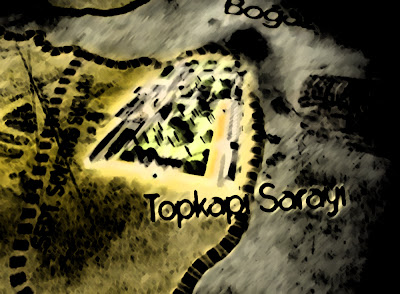
The construction the Topkapi saray began in 1459 and was the official and primary residence in the city of the Ottoman Sultans for approximately 400 years (1465-1856) of their 624-year reign. It was like a castle within a castle, a city within the city. The Harem which was divided in three sections was the world of the unknown, the inaccessible world.
Dolma Bahce Palace, the new palace of the Emperor was built in 1853 on the third hill. Sulleymanya old harem moved there with their ottoman families taking with them the palace culture.
images source:
images source:
Friday, 26 November 2010
Residents of gated communities and gecekondu share the same land but don't meet each other. Disintegration can be detected on many levels: social, cultural, urban. I think it's a dangerous trend. I am looking at modern Istanbul though the prism of disintegration trying to understand how it reflects in urban fabric.
The information contained in this data section summarises research undertaken by Urban Age since 2005. It includes an overview about urban trends in Istanbul and places it in a comparative context with other world cities, including New York, Shanghai, London, Johannesburg, Mexico City, Berlin, Mumbai and São Paulo. By investigating differing patterns of urban density, transport and governance, together with a wide range of social and economic indicators, the information provides unique insight into the DNA of cities today.
Thursday, 25 November 2010
Wednesday, 24 November 2010
my urban archive: what if...
my urban archive: what if...: "So what if those patterns were to make a city?What if Istanbul was read as a carpet?Making a quick sketch about this notion I came up with....."
Monday, 22 November 2010
arabic symbols/ meanings & matching
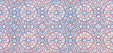
All Arabic patterns are based on the circle and its center. The circle as a symbol emphasizes on religion and God. It also symbolizes the role of Mecca, the center of Islam towards which all Muslim face during prayer. It is a symbol of eternity, justice and equality as well. From the circle derive the four fundamental figures below:
1. The Triangle that stands for harmony
2. The Square that symbolizes the physical world and materiality
3. The Hexagon that stands for heaven
4. And the Star that shows equal radiation towards all directions starting from a central point.
The basic compositional rules of the above elements are repetition and complexity.
So based on those symbols representations, the elements we are willing to represent in our carpet can be shown as follows:
1. The Triangle for all cultural spaces
2. The Square for bazaars and economical districts
3. The Hexagon for religious spaces( mosques and churches)
4. The Star for universities and academies.
Below are some quick depictions of those basic patterns.
Friday, 19 November 2010
Istanbul's unemployment rate
studying arabic patterns
I found some pictures showing how someone can study and understand the arabic geometries.
Above is the link from which the pictures were taken
Thursday, 18 November 2010
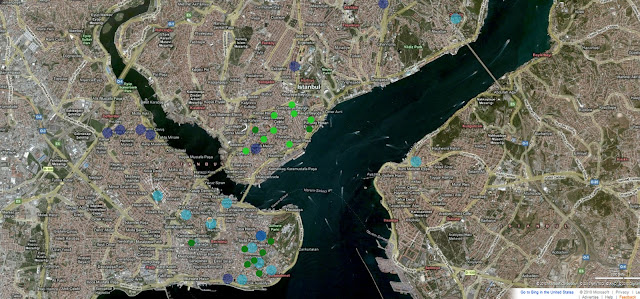
The diagram that follow is an attempt to include the information having gathered up to now in one map going slowly towards the direction of creating a pattern of the city.
A part of my personal blog might also be useful
Subscribe to:
Comments (Atom)


